Bulgarian
 Romanian
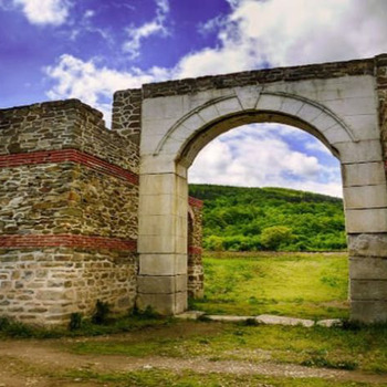
Roman roadside complex Sostra

Overview
Sostra is a well-preserved roadside complex located on one of the most important military roads in the Roman provinces of the Balkan Peninsula - the road "Eskus - Philippopolis". It is the sixth road station located along the ancient road, which, passing through the mountain Hemus, connects the province of Lower Moesia with Thrace. Road stations, settlements, fortifications and observatories were built along its route. There are military units in them, having a security function. The station is 13 miles south of Melta (probably north of Lovech) and 10 miles north of Ad Radices station (Ad Radices - Popina Laka locality - east of the village of Beli Osam, Troyan region).
Sostra is located in the valley of the Osam River, near the village of Lomets, 12 km north of Troyan and 28 km south of Lovech. It developed on an area of 4 sq. Km in the period II-V century as a fortified camp (fortress), civilian settlements, buildings, necropolises.
The fortress is a base camp of an auxiliary infantry unit - the cohort, numbering from 500 to 1000 soldiers. It was built on the ruins of a Thracian settlement, which in the pre-Roman era (1st millennium BC) was inhabited by the Thracian tribe Krobizi.
The name of the Roman roadside station Sostra was first marked on the so-called "Tabula Peutingeriana" from the end of the 4th century, on which the Roman roads in the late Roman Empire were marked.
Sostra goes through several stages of development.
The first period is associated with the activities of the II Matthias Cohort (chohors II Mattiacorum), which built the first fortress wall in the middle of the second century. It lasted until the middle of the third century, when it was destroyed by the Goths.
The second period begins after the Gothic invasions of the late third century during the reign of Emperor Gallienus (254). The fortress was rebuilt and a larger and more stable wall was built. At the end of the 4th century, Sostra was finally conquered by the Goths, and construction continued for the next three decades.
The last period of the development of the castle began after overcoming the crisis in the empire under Emperor Theodosius I and ended at the end of the V century with the complete destruction of the castle.
The construction of the roadside complex is determined by its geographical location, following the nature of the terrain. A relatively flat terrain was chosen, at the same time protected from the surrounding hills, and the Ladana River (Lomeshka River), flowing in the immediate vicinity of the northern wall of the fortification, was used as a natural water source.
A settlement (vicus) was built on the outskirts of the Roman camp, which developed over time and grew into a small town. Archaeological excavations show that within a radius of 4 km in the valley of the Osam River around the castle are the remains of several settlements from the period III-IV century.
Sostra Castle is supplied with water from two sources. The first is located in the Studenets area, and the second - in the Sargyune area. From the places of the springs in the direction of the fortress are directed underground ceramic water pipes, which use the natural slope of the terrain. In order to assimilate the groundwater, a catchment of quarry stones with mortar solder was built. From the catchment to the fortress was also directed a water pipeline, built of constantly connected pipes.
Recommended
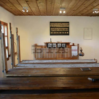
- Crafts Museum
- Natural History Museum - Cherni Osam village
- Skoka waterfall - the village of Kaleytsa
- Sostra Fortress
- Ledevoto Dam