Bulgarian
 Romanian
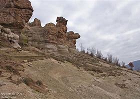
Thracian fortress Chamlak Kayas and Sara Kaya
Overview
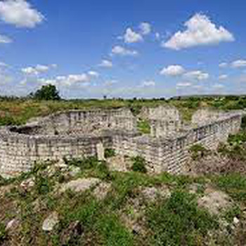
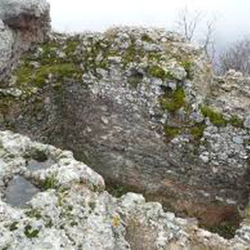
Thracian fortress from the late Iron Age Chamlak Kayas is located on the hill of the same name, 2.43 km southwest in a straight line from the center of the village of Byal Kladenets. The fortification is built on a high, rocky hill on the left bank of the Arda River. The hill has very steep northeastern and southwestern slopes and a steep northwestern slope. The only access to the hill and its fortress is from the southeast on a narrow and long saddle. The fortress is built on the highest part of the hill on a well-leveled site. It has an irregular shape with maximum dimensions of 54x51 m and an area of 1.8 acres. The fortress walls are built of local, crushed stone without solder and were built only from the north, east and south, from which sides the site is most accessible. From the northwest and west the cliffs up to 100 m vertical were sufficient protection. The fortress walls are traced in the form of a placer and their thickness is difficult to determine. Inside, there are many traces of cuts in the rocky terrain, which suggest that it was densely built up, probably with wooden buildings. At 67 m southeast of the fortification, traces of a partition wall can be seen, which blocks the narrow neck of the saddle. The wall is raised from slope to slope and has an approximate length of 70 m. Its construction is identical to that of the fortress wall. The total area of the site with the partition wall is over 7 decares.
Recommended
- Cross over the village of Knizhovnik
- Dimitrovgrad Park Fountain
- The colonnades of Dimitrovgrad
- Bas-reliefs of Vasil Levski and Hristo Botev, village of Spahievo